Storm-scanning satellites enter operations phase
Over the years, forecasters have improved hurricane path prediction significantly, but the ability to predict the intensity of storms has lagged behind. It is difficult and dangerous to collect data in the midst of the storm, and space technology could not provide accurate measurements.
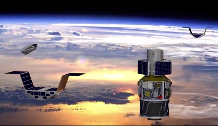
Nasa's Cyclone Global Navigation Satellite System is a constellation of eight microsatellites which is on track to collect data for the 2017 hurricane season (image: Nasa)
Earlier this month, NASA’s Cyclone Global Navigation Satellite System (CYGNSS) mission successfully completed its development and commissioning phase and moved into the operations phase. The constellation of eight microsatellites – the first engineered and fabricated by Southwest Research Institute (SwRI) – has now started on-orbit instrument calibration and validation and is on track to collect data for the 2017 hurricane season.
Following their launch December 15, 2016, the CYGNSS spacecraft entered a low-inclination, low-Earth orbit over the tropics. From this vantage point, they will make frequent measurements of ocean surface winds in and near a hurricane’s inner core to better understand how storms intensify.
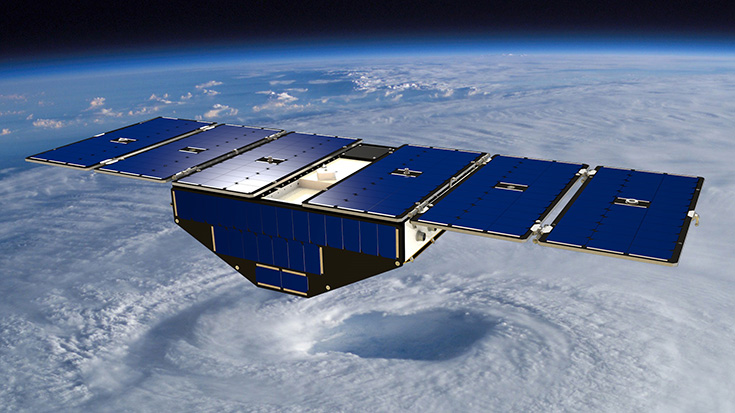
Conceptualisation of CYGNSS in orbit (image: Nasa)
“All spacecraft have completed their engineering tests and are performing to specifications,” said SwRI’s Randy Rose, CYGNSS project systems engineer. “It is very gratifying to see how well everything is working. Weather scientists are going to get everything they’d hoped for, and more.”
Because GPS signals are able to penetrate the intense rain in a storm’s eye wall, CYGNSS uses these signals reflected off the ocean surface to calculate wind speeds. By advancing our understanding of how storms intensify, CYGNSS data are expected to enable improved hurricane forecasting.
“With CYGNSS, we’re doing real science with a satellite small enough to literally sit on your desk,” said John Scherrer, a program director in SwRI’s Space Science and Engineering Division who oversaw satellite construction. “While these satellites might be small, they provide big returns with data that we expect to one day help weather forecasters make better predictions about storm damage and more informed decisions about evacuation orders.”
CYGNSS demonstrated its ability to observe surface winds during its first tropical storm flyover on March 6, 2017, just hours before Tropical Cyclone Enawo made landfall on Madagascar.
“The satellites’ measurements responded as expected to changes in the wind speed as they approached and passed over the storm’s centre, showing strong and reliable sensitivity throughout,” said Chris Ruf, professor of atmospheric science at the University of Michigan and CYGNSS Principal Investigator.
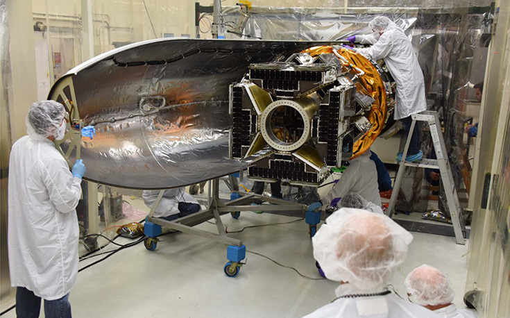
The first of the constellation of eight microsatellites being engineered and fabricated by Southwest Research Institute (SwRI)
The CYGNSS mission is led by the University of Michigan. SwRI led the engineering development and manages the operation of the constellation. The University of Michigan Climate and Space Sciences and Engineering department leads the science investigation, and the Earth Science Division of Nasa’s Science Mission Directorate oversees the mission. SwRI’s office in Boulder, Colorado, USA, hosts the mission operations centre, the MOC, which commands the spacecraft, collects the telemetry, and transmits the data to the science operations centre at the University of Michigan.